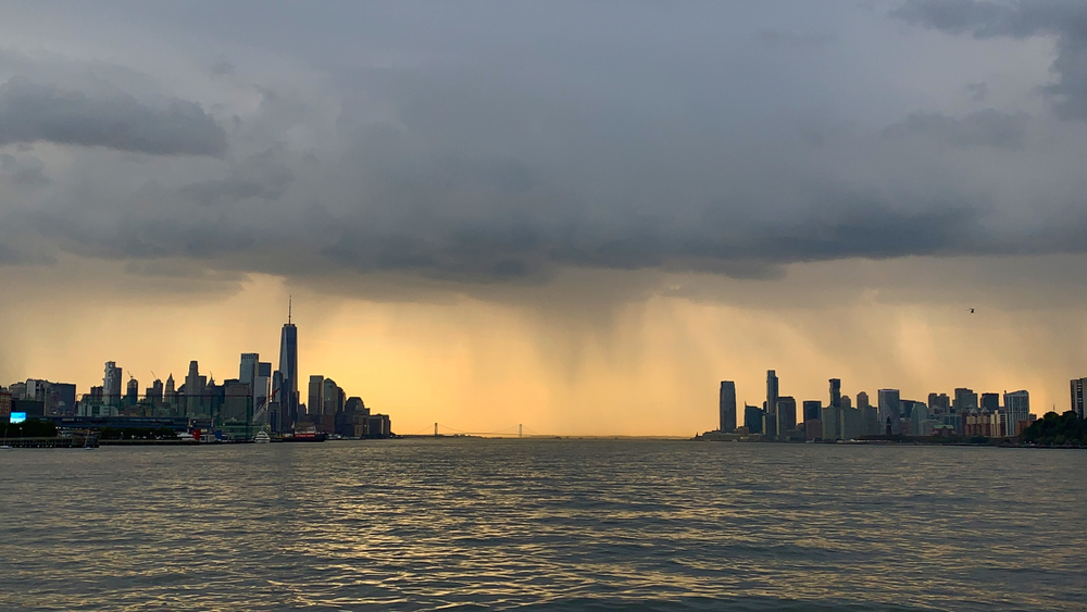
After three days of air rendered irrespirable by fire smoke in Canada and Minnesota, Saturday 18 July New York will have to deal with another weather problem. A series of thunderstorms will pass through much of the north-east of the United States and could produce very strong gusts, concentrated rains in a short time and sudden flooding. The passage of disturbances should help to disperse the smoke, which according to the National Weather Service will continue to affect the region at least until the afternoon.
The first rounds can arrive early in the late morning, while the most intense phase is scheduled between the afternoon and the first evening. Much of the storms should have moved east by 21:00, although the location and intensity of the individual cells may be defined only a few hours before their arrival. For New York City, the north-east of New Jersey and the southern part of Westchester County there is an alert for possible flooding from 10 am on Saturday to 2 pm on Sunday. The National Weather Service bulletin reports more waves of rain during the day.
The Storm Prediction Center has included most of the subway area in level 3 on a scale of 5, called “enhanced risk”. It is a frequent category for the New York area and indicates the possibility of strong storms scattered. The phenomena will be irregular: a neighborhood could receive an ordinary amount of rain while, a few kilometers away, a temporal cell can produce bursts and precipitations much more intense.
The main danger concerns the wind: the strongest gusts could reach the 60-70 hourly miles, that is between 95 and 110 km hours, enough to break branches, break down trees and damage the electric lines. The likelihood of colds comes to 45 percent in the most exposed areas. The National Weather Service also indicates a 5 percent tornado risk between north-east New Jersey and New York metropolitan area. It is therefore a possible scenario, but much less likely than the damage caused by the wind and flooding. The Storm Prediction Center believes that some cells can develop as supercells, organized storms capable of producing more violent phenomena.
On average, there are between 25 and 40 mm of rain, with accumulations located between 50 and 100 mm at the points where more storms will pass on the same area. During the most intense rounds could fall up to 40-50mm in an hour. Such quantities can quickly exceed the capacity of caditories and flood roads, underpasses, stations and semi-trailer apartments. The most vulnerable areas are the north and center of New Jersey, New York City, Long Island, South Westchester and the coast of Connecticut.
The risk of particularly strong gusts is greater in New Jersey, Poconos, Catskills and the lower part of the Hudson Valley, and decreases further east. Long Island and coastal Connecticut remain exposed to torrential rains. In downtown and south of New Jersey some thunderstorms could also produce hail.
In the meantime the air quality alert remains in force. The Department for Environmental Conservation of the State of New York provides for Saturday levels classified as “unhealthy” in the metropolitan area and Long Island, a category that covers the entire population and has major risks for children, elderly people, pregnant people and those suffering from heart disease or respiratory disease. Rain and air change should gradually improve the situation without an immediate and uniform return to normal. The state sent another 70,000 N95 masks to the New York area. State indications recommend checking the updated AirNow index before spending a lot of time outdoors.
The city department for emergency management has activated the plan for sudden floods. Municipal teams have begun to control and free the caditories in the areas that flood more often, while the units that intervene for fallen trees have been alarmed. The weekend coincides with numerous events and watch parties related to the World Cup: the city recommended delays in travel and prepare to stop outdoor activities quickly. According to NYC Emergency Management, those living in a basement or on the ground floor should decide in advance where to move if the water began to rise.
The conditions should improve on Sunday, when the disturbance will move east. Until then the recommendation is to enter a building as soon as you feel a thunder, avoid underpasses and roads already covered with water and follow the warnings of the city. To receive them on the phone you can send “NOTIFYNYC” to the number 692-692.
L’articolo After smoking, strong thunderstorms come to New York proviene da IlNewyorkese.